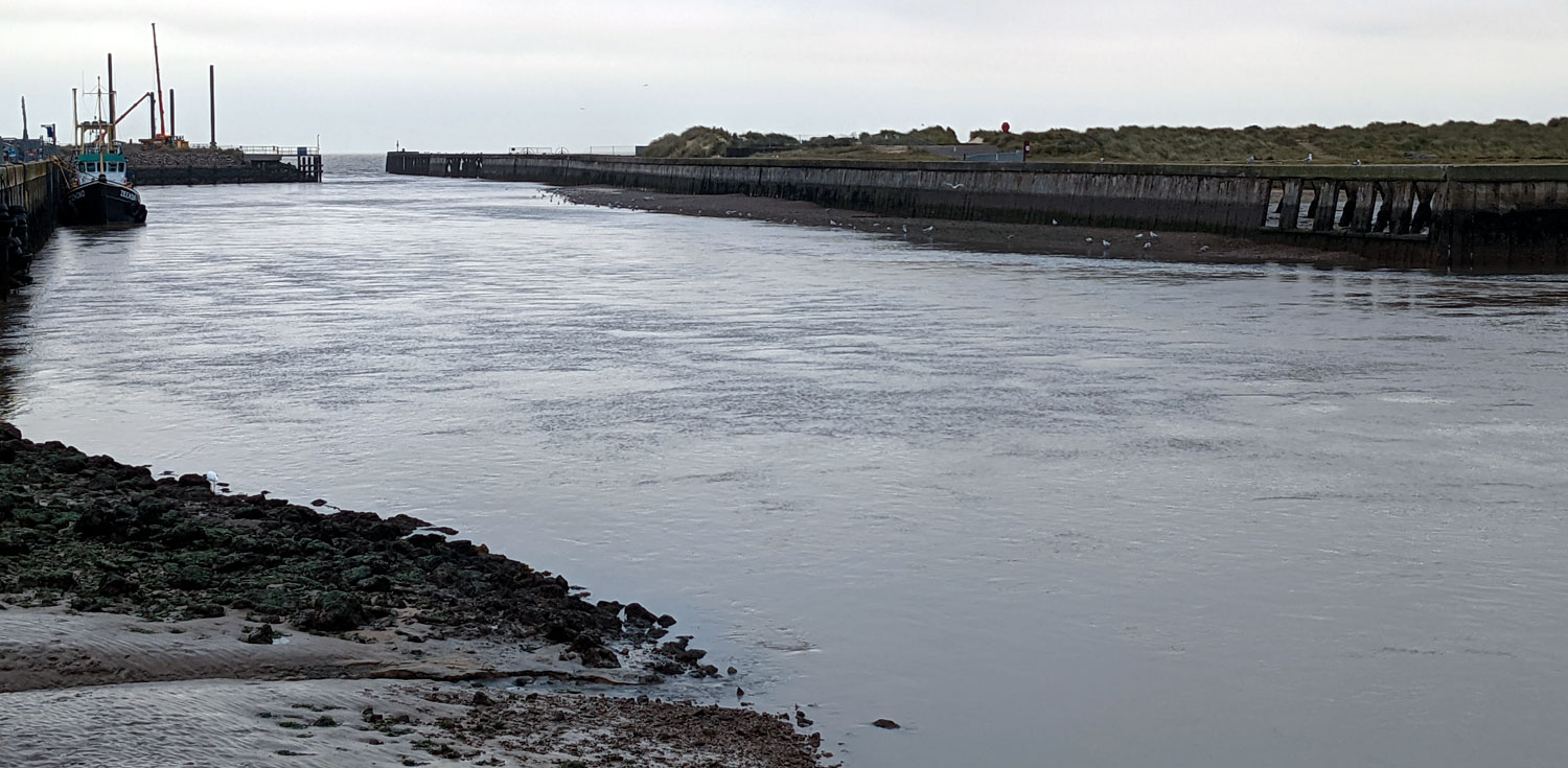
The photo above was taken from the inner end of the “new” north harbour wall looking out to sea.
In the immediate foreground there is a little mud gully caused by flow from the sluice from the North marshes.
This is notable as this section of the river is the shallowest.
At this state of tide, the deepest part of the channel is around 20 ft out and would be a little over 5 ft deep.
On the South side, opposite the moored tug, you can clearly see the shingle bank which extends North, underwater towards the tug, in a gradual gradient.
The swell causing the mooring issues on the North harbour wall is caused by waves entering the harbour, which when reaching the shallow shingle bank, build and then spread North.
The above photo, taken from the same position but slightly to the right, is of the entrance to Dunwich creek.
Even at this very low state of tide the flow rate is still significant, possibly running slightly faster than the main river.
The areas of wall that have been removed or “Windows” were an attempt to disperse the waves that built up on the shingle bank.
A little like shutting the stable door……….
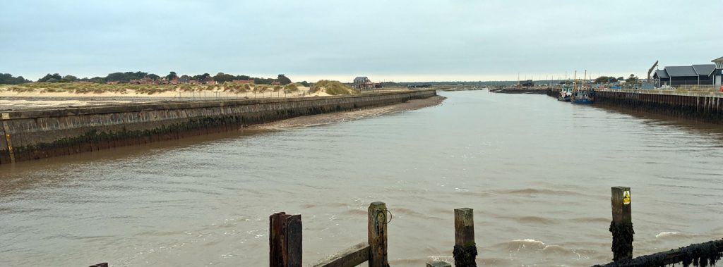
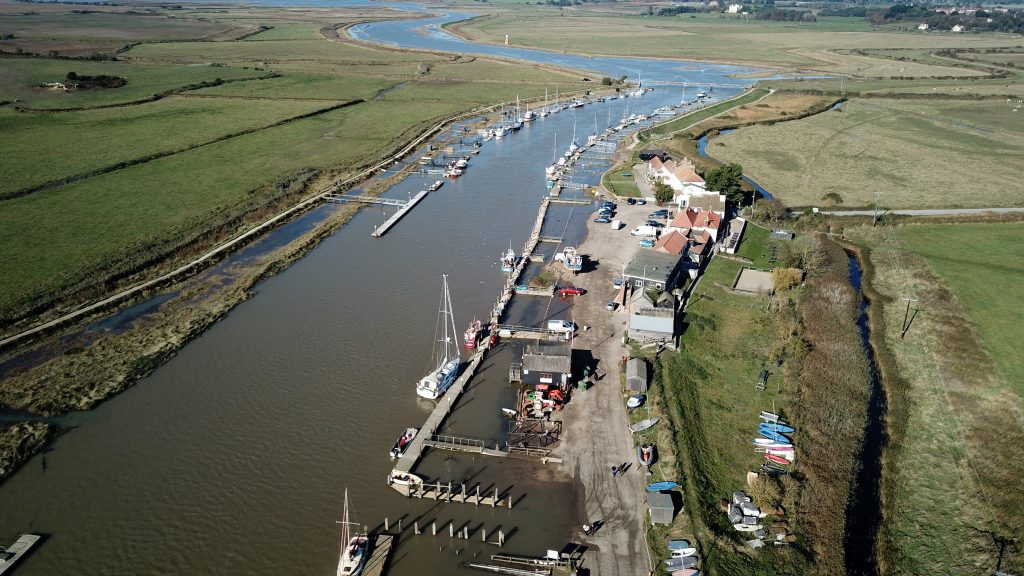
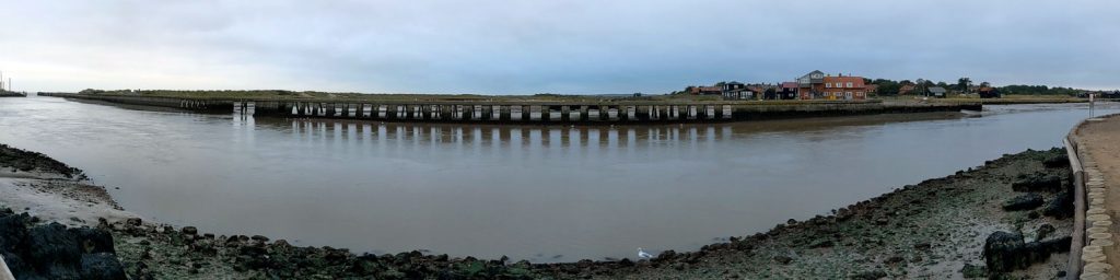
Taken from the “Knuckle”, looking up the river.
Without any navigation buoys or marks, finding the correct channel relies heavily on local knowledge.
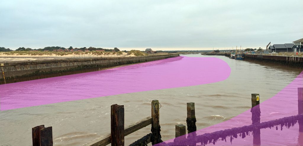
The pink areas are not navigable for any vessel drawing more than 4 or 5ft at Low water.
This pink area is also the area where much of the North harbour wall swell is created.
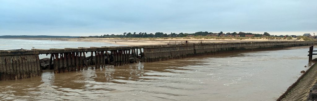
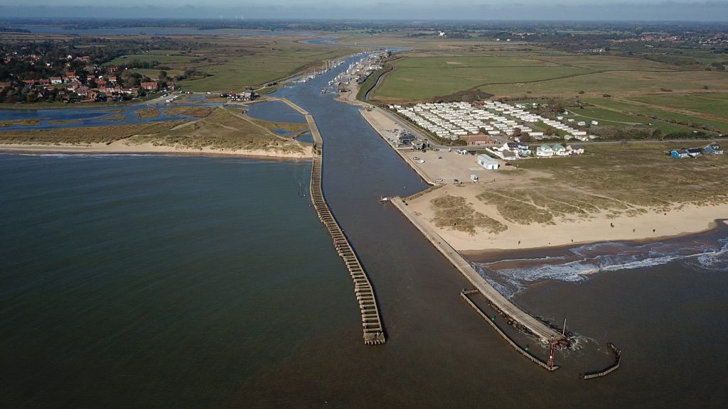
Moving out towards the sea, this area is the inner South Pier, with Walberswick beach in the background.
Though the windows can be seen the rock maul that was built in the 70’s I believe.
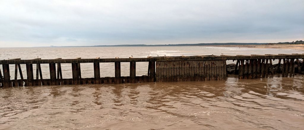
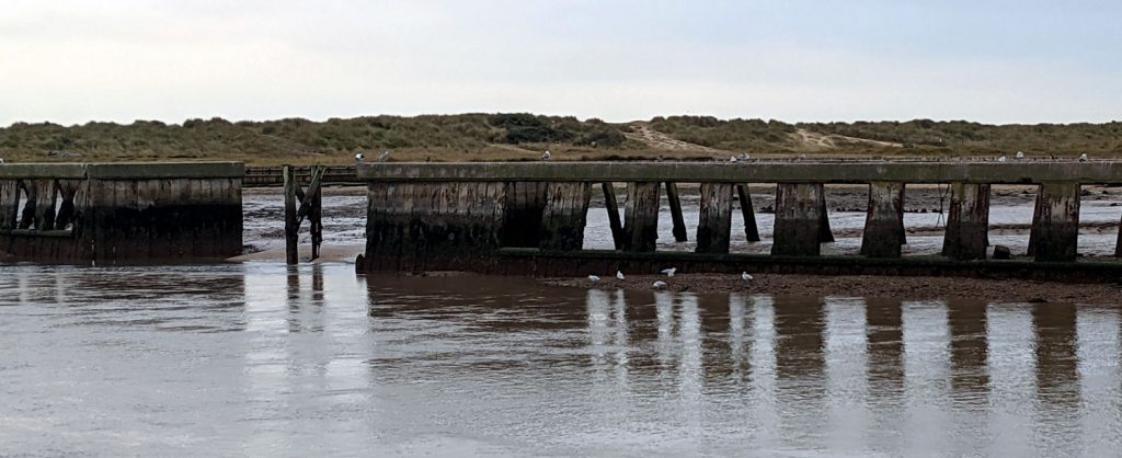
This is the mid section of the South Pier.
As can be clearly seen, the South pier is a series of interconnected posts and apart from seagulls it is not designed to carry any traffic of any kind.
The lower section of shuttering prevents sand from Walberswick clogging the channel, whilst the open windows allow the Northerly back eddy flow to mitigate the waves entering the harbour.
Filling in these windows, in any way, will cause much debate from local users!
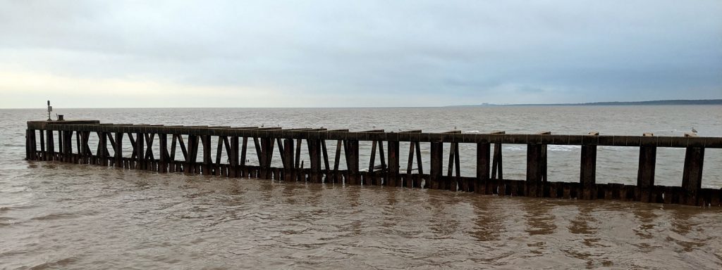
The outer section of the pier follows the same route as the three earlier piers.
You can just see parts of these older piers sticking out of the water on the far side through the windows.
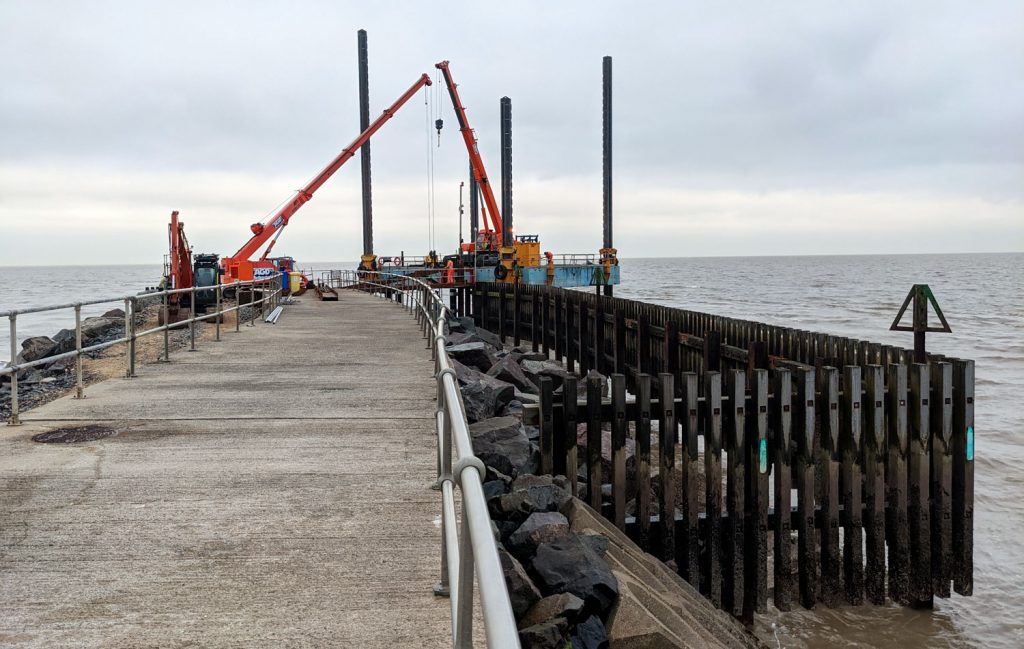
This is a photo of the works to the North Pier.
There is significant debate locally about whom this work is going to benefit.
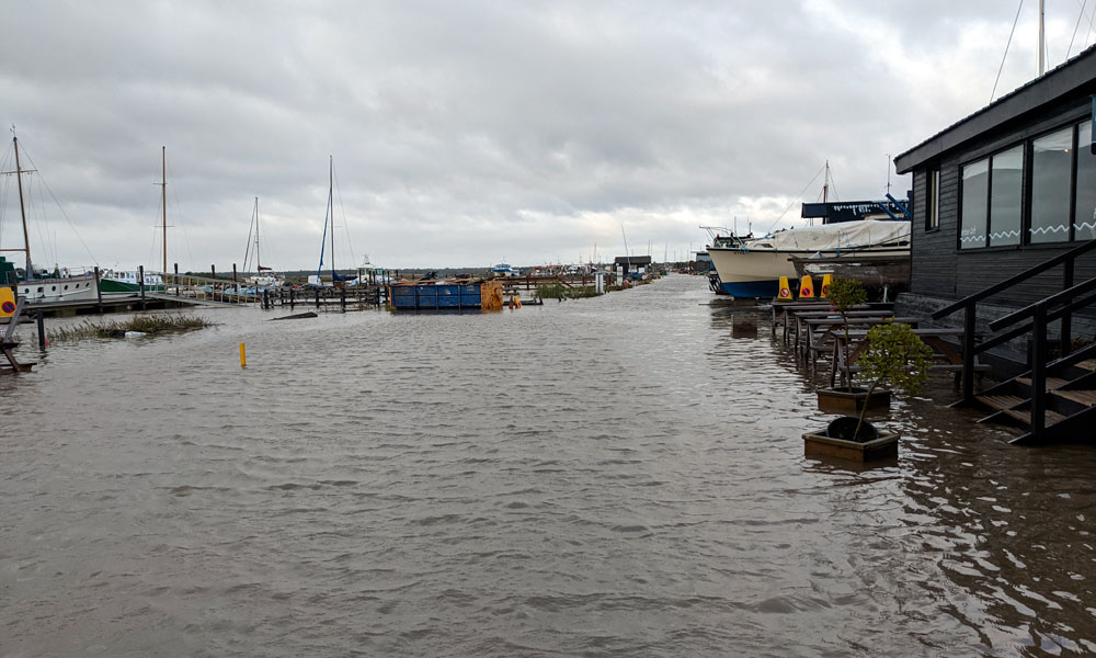
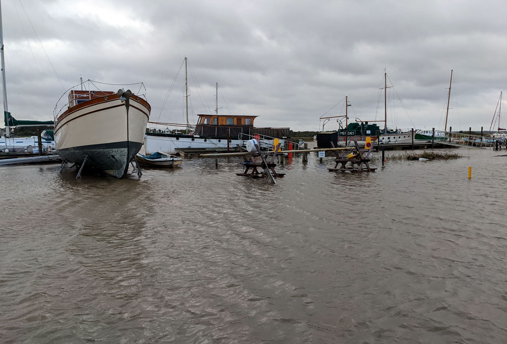
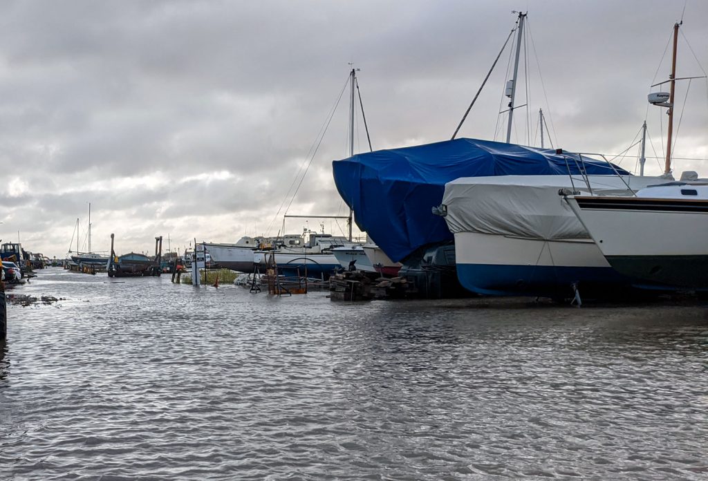
Photos taken at 10:35 20Oct.
This was a smallish surge tide of 2.16m
It answers many who wonder why we don’t surface the road, as three or four of these events a year would destroy most surfaces.